
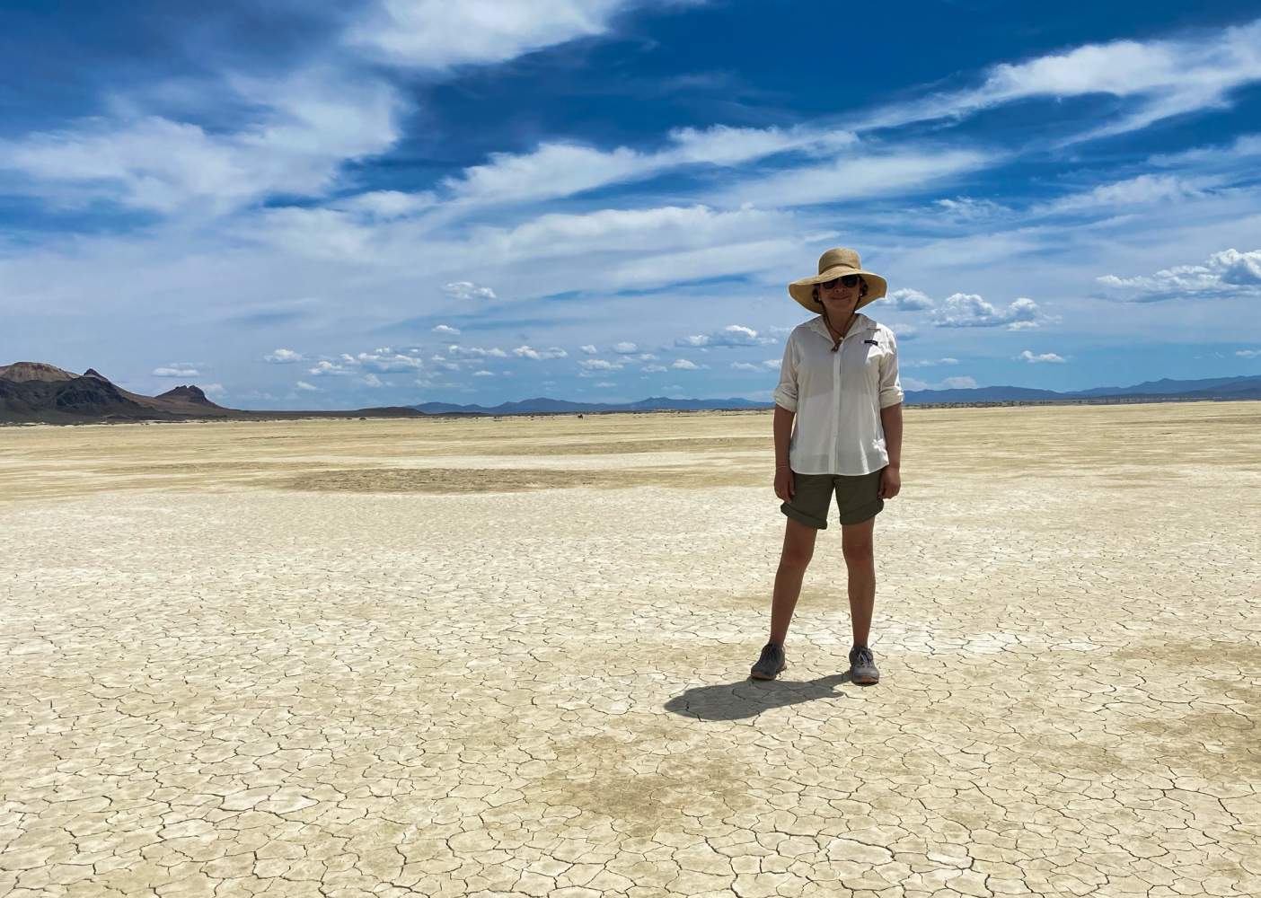
The temperature was already closing in on the mid-day high by the time I reached the BLM’s Black Rock field station. Gazing out over the alkali pan of the playa, a stiff wind whipped the loose surface into a column of dust several hundred feet high before sending it sailing east into Selenite mountains.
A list of items raced through my jittery mind as the first members of the team began to arrive. Anxiety loomed as we were still unsure if our team leaders would get there in time. Contingent options were few and sub-optimal. Two of our key players had already notified us that they were not going to be able to make it: one had the most knowledge of our planned route, and the other unfortunately delayed in the Utah backcountry. Additionally, Dan’s crew, the largest contingent of the team, had gotten off to a late start.
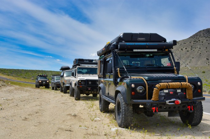
Endless hours of effort had been devoted towards getting to this day. For a good portion of the team, this was the first real social experience emerging from 14-months of pandemic isolation. The excitement glowed on their faces as each of the six other vehicles arrived.

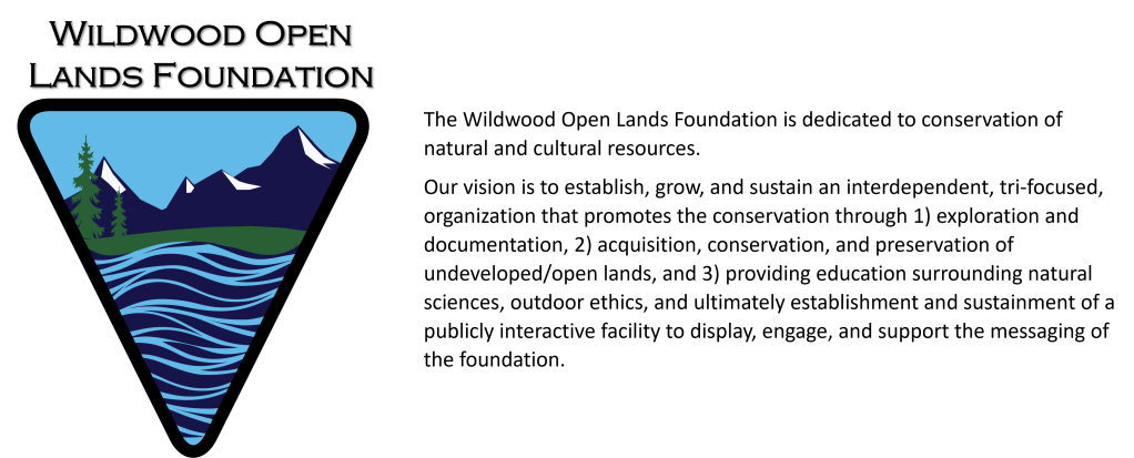
The years leading up to and including 2020 (regardless of the Burning Man event) have seen a steady increase in visitation to the Black Rock Desert High Rock Canyon Emigrant Trails National Conservation Area (NCA). That, combined with the sharp rise in popularity of vehicle dependent & off-road travel further exacerbated by the social dynamics surrounding the pandemic, the visitor impact exceeded the management systems in place that serve to maintain the pristine environment of the NCA. The Bureau of Land Management (BLM) maintains (appropriately) open and unconstrained access to this matchless environment. The underlying driver for developing this joint program is to support messaging around acknowledging the importance of these 1.2 million acres.
This was our beta test, our tangible proof of concept for a project the Wildwood Open Lands Foundation (WOLF) had been developing in partnership with the Friends of Black Rock High Rock (FBRHR). The project had become a personal mission for several of us. It had been nine months since conceptual ideation turned operational. Our goal: to develop a guided, interpretive, ‘overland-style’ four-wheel touring experience in the NCA. Objectively, we sought to construct a framework whereby a participant would enjoy an adventuresome, educational, fun, safe, positive, unique experience engaging the natural, cultural, and historical riches of the NCA.
In its fully developed commercial format, a professional guide service will replace our non-profits in the role of leading clients through the NCA using the programming we’ve been developing. For now, our team was completely composed of hand-selected volunteers with varied skills and experience, and in some cases their families as well. Their feedback will provide valuable insight as we continue development towards formal operationalization.
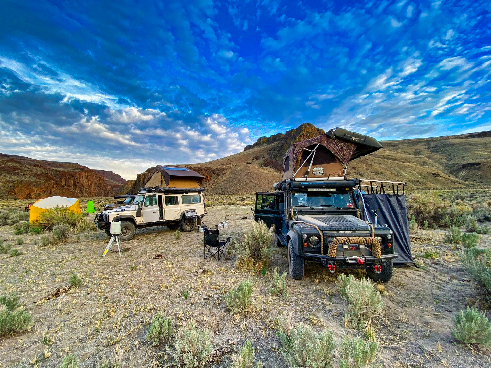
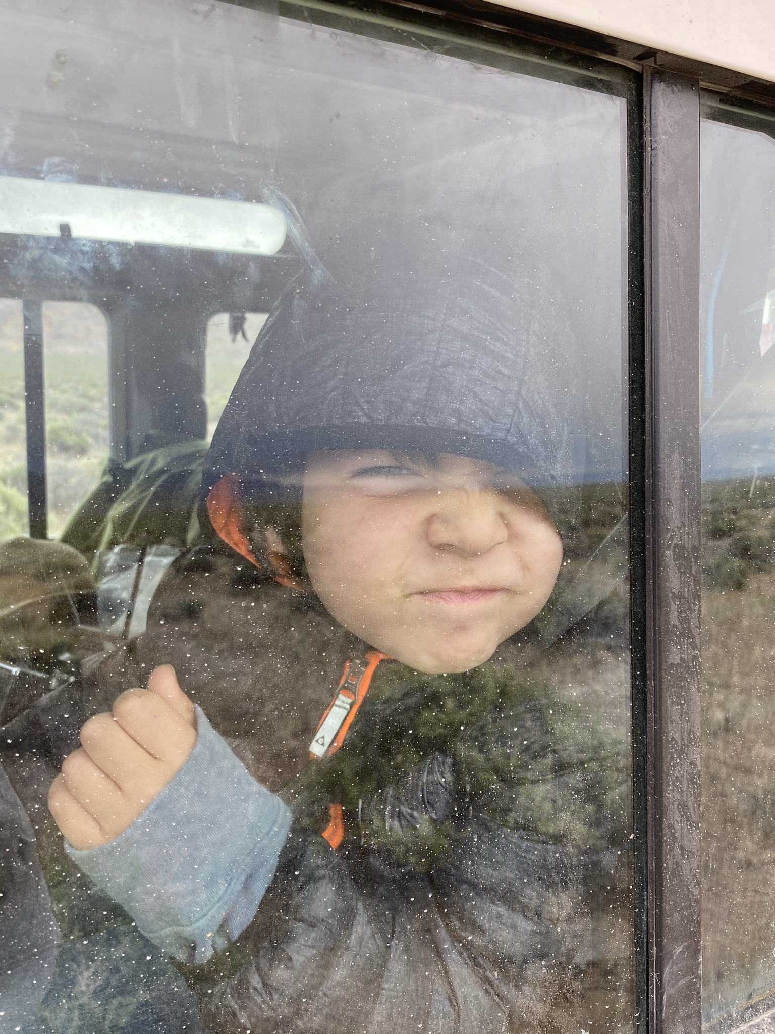
The easterly wind that was scouring the playa brought us a sweet breeze heavy with the pollen of blooming sagebrush. Most of the team had arrived and was huddled in the shade of the gazebo surrounding a topographical map of the NCA. My wife, Darla, was corralling our youngest son to the interpretive displays surrounding the BLM field station. Stacey Wittek, Executive Director for Friends of Black Rock High Rock and my co-conspirator in this project, completed the pre-departure checklist.
I sighed in relief when Dan’s pair of Landcruisers came into view. Now, with our team assembled we kicked off the drivers’ meeting. To date, the group had met several times during the preceding months via zoom, today was the first time in person. With brief re-introductions and final instructions, the vehicles lined up in a caravan and rolled out to our first destination.
Boston, MA: June 1998
Summer Sunday mornings in Boston are consistently good for two things. 1) Sox game, 2) Sunday Globe. The window in our bedroom faced an alley behind our apartment building on Commonwealth Ave. A steady rain fell into oceanic puddles that echoed through the brick canyon. I semi-lucidly hobbled to the kitchen for a cup of coffee, almost knocking over the stack of unopened mail on the dining table. “Game’s rained out” Darla announced from the living room of our tiny apartment. She had already begun dissecting the Sunday edition. 1 out of 2 today, I guess. Coffee in hand and passing the stack of mail for the second time I grabbed the newest Outside magazine off the top of the pile.
Sipping coffee, we talked about how to spend a rainy Sunday. I flipped through the pictures in Outside, stopping at an article about a retired millionaire who decided his amassed wealth was best spent creating the world’s largest private nature preserve. This was the first time I’d heard of Douglas Tomkins. I found myself captivated and inspired by his story and mission to “preserve biological and cultural diversity” by going it essentially alone under his own resources. Thinking to myself, one day we’ll do that too. I turned my attention back to coffee and our conversation.
War on the Black Rock Desert and the murder of Lucius Arcularias illustrate some of the mayhem and violence that has plagued the territory surrounding the from the earliest western expansion by European settlers extending through 2021.
Following the two battles of the Pyramid Lake War in 1860[i] an uneasy truce lay on the land. A band of Smoke Creek Native Americans, led by a Paiute the white settlers named ‘Smoke Creek Sam’, continued to steal cattle and raid stations along the edge of the Black Rock and Smoke Creek deserts.
In 1865 a Pony Expressman was killed north of Smoke Creek. Shortly thereafter the body of one of the owners of the Granite Creek Station, Lucius Arcularius, was found in Wall Springs. Arcularius was well-liked by both Native Americans and white settlers. He was rumored to lend guns to local Indians to hunt. His death was blamed on the Paiute, although it seemed unusual given his relationship, and he was likely murdered by other white men.
Regardless, this set off a manhunt. On March 14th, Captain Wells and Company E of the 1st Nevada Cavalry Battalion killed 29 Paiutes at Winnemucca Lake. Captain Wells reported fierce combat between soldiers and Paiute warriors. Witnesses claimed that 19 women and children were among the 29 killed. The incident became known as the “Battle at Mud Lake”
Days after this event, a young Paiute man walked into Granite Creek Station and asked for Arcularius. Four white men were there, one put a rifle in his face and killed him point blank. The war was on.
Shortly after, a small party out of Unionville saw smoke rising from the Granite Station. When they arrived, it appeared that the white men fought from the sod structure and the Paiutes from a corral, 30 yards away. Curry, one man in the who’d been shot, was found in the house, the legs below the knees were missing. Creele, another man in the battle, had struck out towards Boiling Hot Spring. He had been captured and returned to the station. A portion of his skull and fragments of his jaw were found between two piles of stones. A third man, Simmonds, took to the road and was shot down. The body was mutilated.[ii]

A week earlier Stacey and I had pre-run the playa section to determine the safety of the playa surface which is entirely dependent upon the dryness of the soil. Our next planned stop was triangulated between Steamboat Rock, the Calico Mountains, and Blackrock Point. NCA playa orientation and basic vehicle spotting hand & verbal communication techniques are topics that would be discussed as they’d be skills used later in the trip.
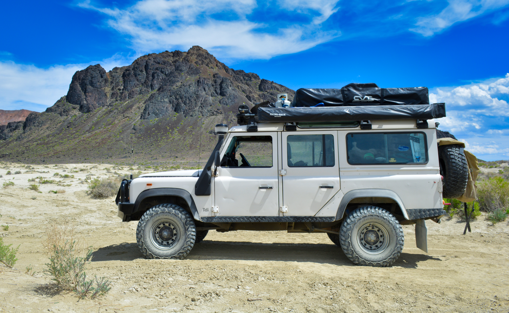
The driving surface of the playa is flat and smooth as any interstate highway. I placed myself in the middle of the convoy to keep good visual and radio contact/control with the entire group. Stacey served as our lead and navigator in this section. Dan (WOLF Board Director and beta guide) was the last vehicle of the convoy in the role of safety and medical response.
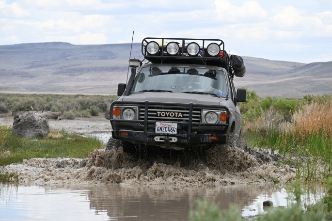
Angus, our beloved Defender 110, floated across the playa. The vehicles moved into a staggered formation across the desert. Slow enough to keep cohesiveness, fast enough to keep the dust from overwhelming us. Contrails propagated from each vehicle beneath a brilliant sky draped with gossamer clouds.

Preventing playa dust infiltration is a fool’s chore. It will find its way into every crevice of your vehicle, gear, and body. I specifically remember the smell and taste. Not gritty like beach sand, but musty, metallic, and sour.
The northwestern region of Nevada, including the NCA, has a long geologic, paleontological, and anthropological history.
The Black Rock Desert is the largest playa in North America. This playa is one of the last remains of the Ancient Lake Lahontan (other remains are Honey Lake, Pyramid Lake, and Carson Sink). An endorheic lake (no outlet to the ocean), at its largest, around 12,700 years ago, the playa would have been under 500 feet of water.
During the most recent ice age, the Pleistocene Epoch, Nevada was not so icy but very wet! Two great lakes, Lake Bonneville, and Lake Lahontan covered much of Utah and Nevada as well as a great deal of Oregon and Idaho. Plants were similar to today with perhaps more pinyon and juniper forests.
When the ocean receded, it was a flood plain where dinosaurs such as sauropods and tyrannosauroids ruled. Pleistocene animals included giant ground sloths, camels, horses, and mastodon.
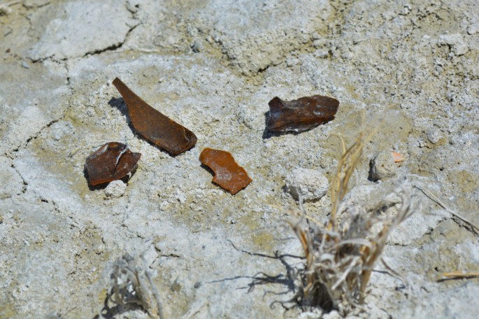
According to the author of Black Rock Desert, Christopher Brooks[iii], “In 2013 researchers determined that the petroglyphs at Winnemucca Lake were created by humans between 14,800 to 10,500 years ago making them the oldest known petroglyphs in North America.” As evidence of their presence, obsidian flake and bone tools remain.
Climate shifts in the Pleistocene period warmed and the lake receded. Pyramid and Walker lakes are the remnants of these water bodies. Around 9000 – 1200 years ago early cultures made tule sandals, bags, and rope, baskets from the lush marshes. On the ridges, crescent-shaped tools were used to stun waterfowl and primitive duck decoys have been found. Washoe, Shoshone, Goshutes, Utes, and the Paiutes are the descendants of Paleo-Indians throughout the greater basin area.
These were and are rich cultures that were extraordinarily adapted, and sophisticated hunters, agriculturists, makers, and storytellers. Usually, in small bands, they enjoyed social gatherings to combine efforts for pine nut gatherings, rice grass harvesting, fish, and rabbit runs. On rendezvous, they would compete in sports, gamble, dance, share knowledge, trade, and meet relatives.
Northern Paiute territory around the time of Anglo-European arrival stretched over 78,000 square miles. The culture centered on the Humboldt, the Truckee, the Carson, and the Walker River.
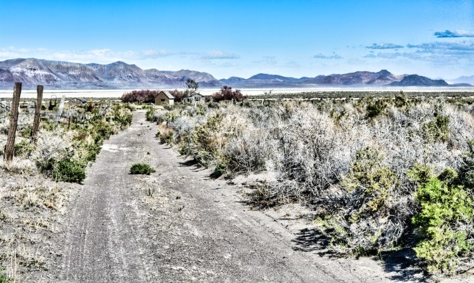
It is critical to exit the playa through a fenced designated route at Black Rock Point. There are several reasons behind this design and location. Where the playa meets Black Rock Point is the lowest point in the alkali pan. Any water from the playa collects here. That can often result in a dry surface layer atop an unstable sub-surface matrix. The approach to the designated route should be clear from about a mile into the playa. A missed approach from the north or south, by as much as 1/10mi, could leave a vehicle stuck to its frame rails in caustic mud.
Additionally, the dunes that surround the playa are a fragile desert ecosystem, home to several species. Driving over the dunes outside of the designated routes is immensely impactful.
On our approach we could not see the designated route. This revealed an oversight in our planning. While we’d previously dropped a waypoint at the entrance of the route, there should have been at least one other intermediary point as well. Finding ourselves a bit far north to the correct location, Stacey reconnaissaned while Dan and I kept the group safely behind until she was able to reconcile the trail location. Conundrum resolved.

Truckee, CA: January 2020
Traffic moved swiftly along Interstate 80. I stared blankly out of my office window overlooking the highway, silent and motionless. Northstar-at-Tahoe rises on the south side of Martis Valley beneath a platinum sky. I had just returned from the Cancer Center where I sat with Darla while she bravely received her third infusion of doxorubicin.
Time and again we have been told that our lifetime is not a guarantee. Nor is health. Our world was already upside down. We had no idea how much our perception of normality in 2020 was still going to change.
Thoughts of pursuing some life goals, that had been put off to ‘later, when the timing and conditions are better’ changed to ‘how do we start now?’ Travel, projects, and interests took on a different perception with a new sense of urgency.
Black Rock Point sees a lot of traffic. Despite a clearly marked designated route, some visitors continue to drive over the dunes, around the corral fencing. An objective of this program was to introduce or reintroduce, low impact off-road travel practices. Here was a perfect example and opportunity. Stacey, a Leave-No-Trace trained instructor, reviewed concepts and practices while the team ate lunch. Before leaving Black Rock Point, we took time to return to the entrance at the dunes and, as a team with hand tools, erased the tire ruts and built some additional visual cues with the materials at hand to help redirect vehicles onto the trail.


Lettie and the Laudanum
“We shall never forget that camp (either at Black Rock or Double Hot Springs, some 5 miles farther north). Mother had brought some medicine along. She hung the bag containing the medicine from a nail on the sideboard of the wagon. My playmate, the Currier girl, who was of my own age, and I discovered the bag, and so I decided to taste the medicine. I put a little on my tongue, but it didn’t taste good, so I took no more. The Currier girl raised it, made a wry face, and handed the bottle back. My little sister Salita Jane, wanted to taste it, but I told her she couldn’t have it. She didn’t say anything, but as soon as we had gone, she got the bottle and drank it all. Presently she came to the campfire where mother was cooking supper and said she felt awfully sleepy.
Mother told her to run away and not bother her, so she went to where the beds were spread and lay down. When mother called her for supper she didn’t come. Mother saw she was asleep, so didn’t disturb her.
When mother tried to wake her later, she couldn’t arouse her. She had drunk the whole bottle of laudanum. It was too late to save her life.
Before we had started [our journey] father had made some boards of black walnut from alongside the wagon. They were grooved so they would fit together, and we used them for a table all the way across the plains. Father rook these walnut boards and made a coffin for Salita and we buried her there by the roadside in the desert.
Three days after my little sister Lettie drank the laudanum and died, we stopped for a few hours, and my sister Olivia was born. We were so late that the men of the party decided we could nor tarry a day and had to keep right on going, even though there was a new baby. The going was terribly rough. the men walked beside the wagon and tried to ease the wheels down into the rough places, but despite this it was a very rough ride for my mother and her newborn babe.”
Lucy Ann Henderson, 1846[iv],[v]
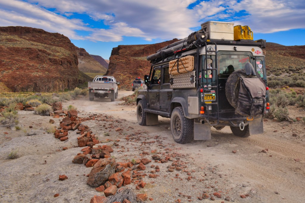
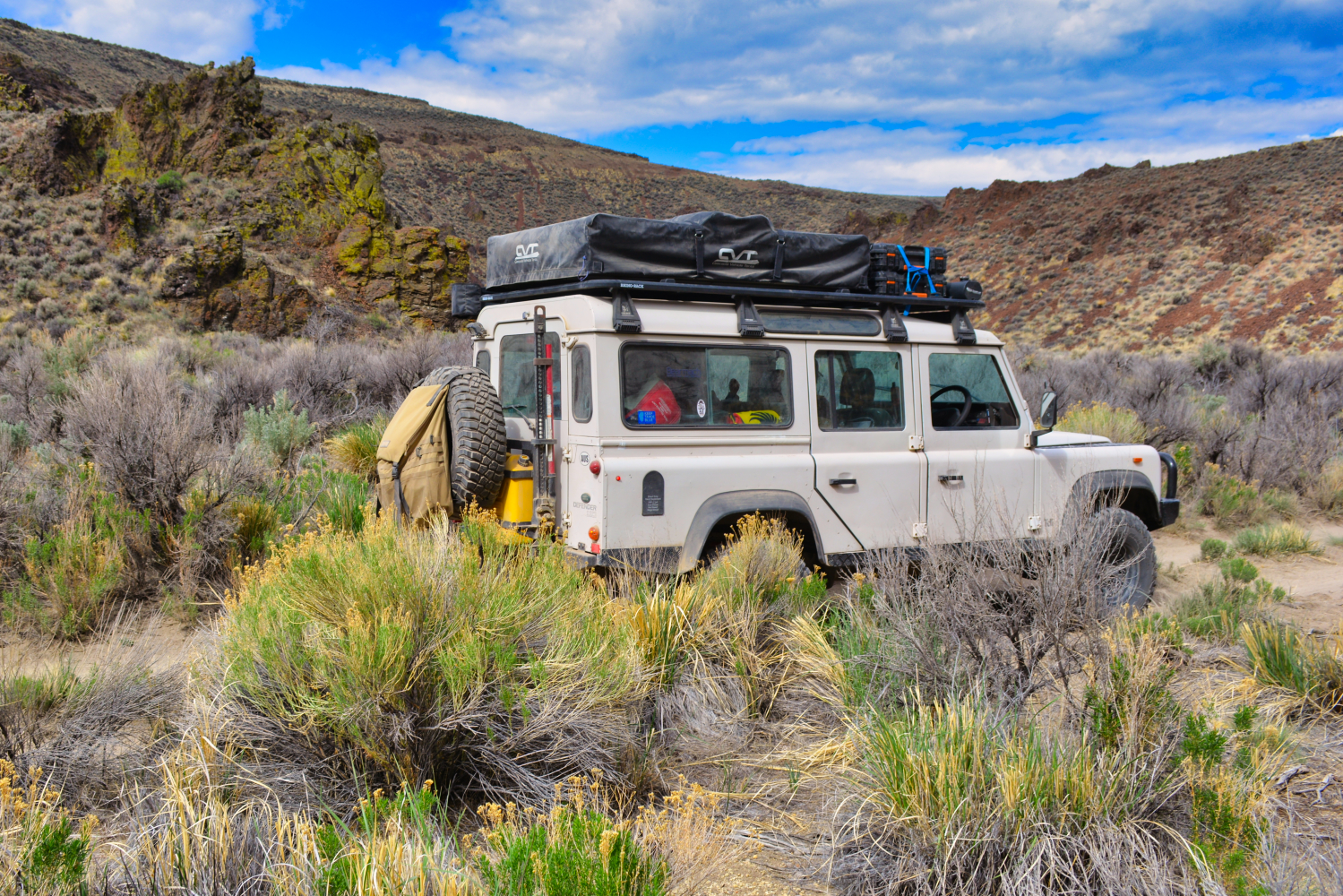
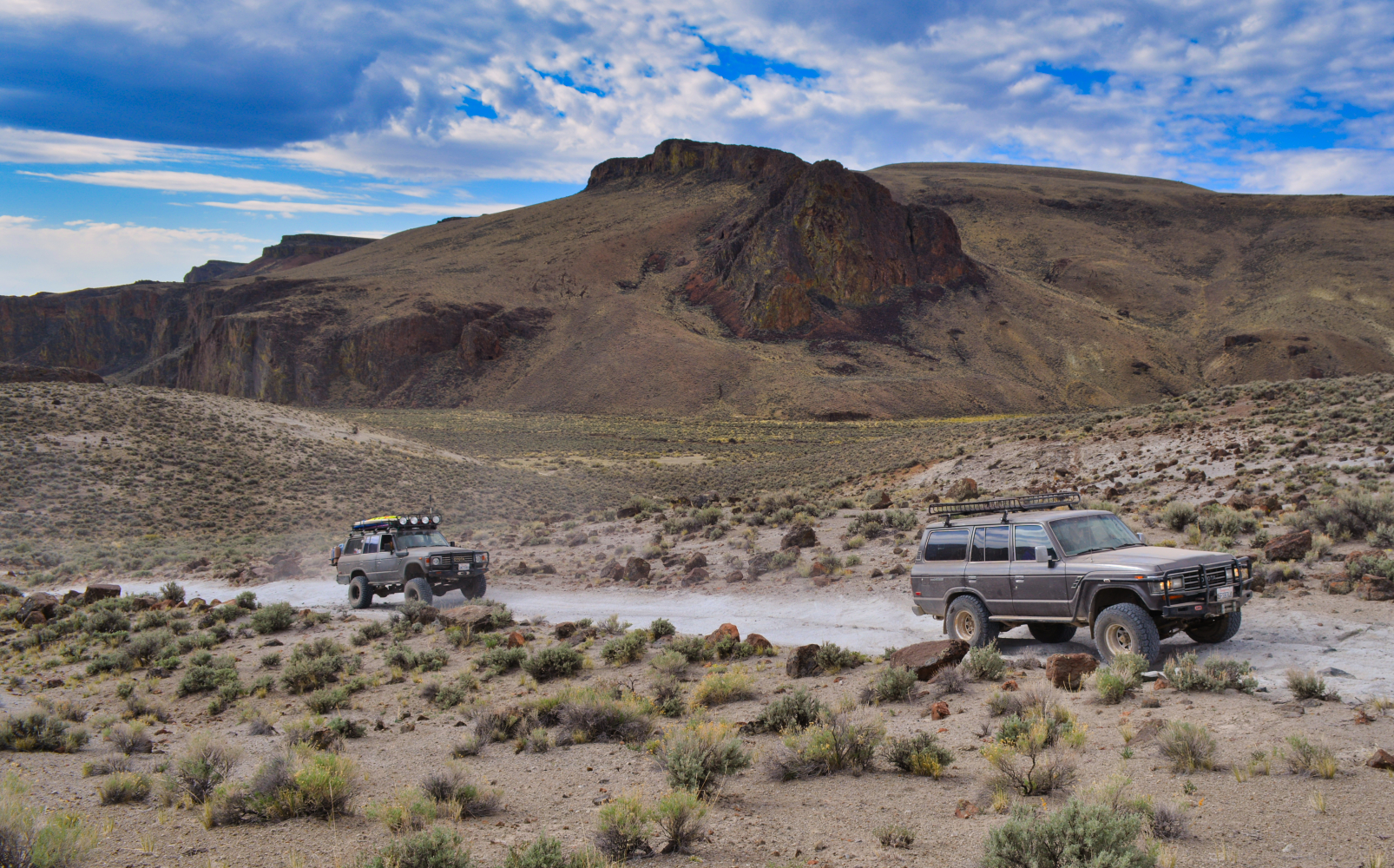
Our route on the Lassen Applegate Emigrant Trail continued northbound, just up-slope of the eastern boundary of the playa. The terrain would not be considered technical yet traveling in an 8-vehicle group is nonetheless a slow and steady progression.

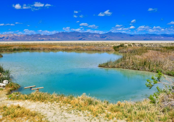
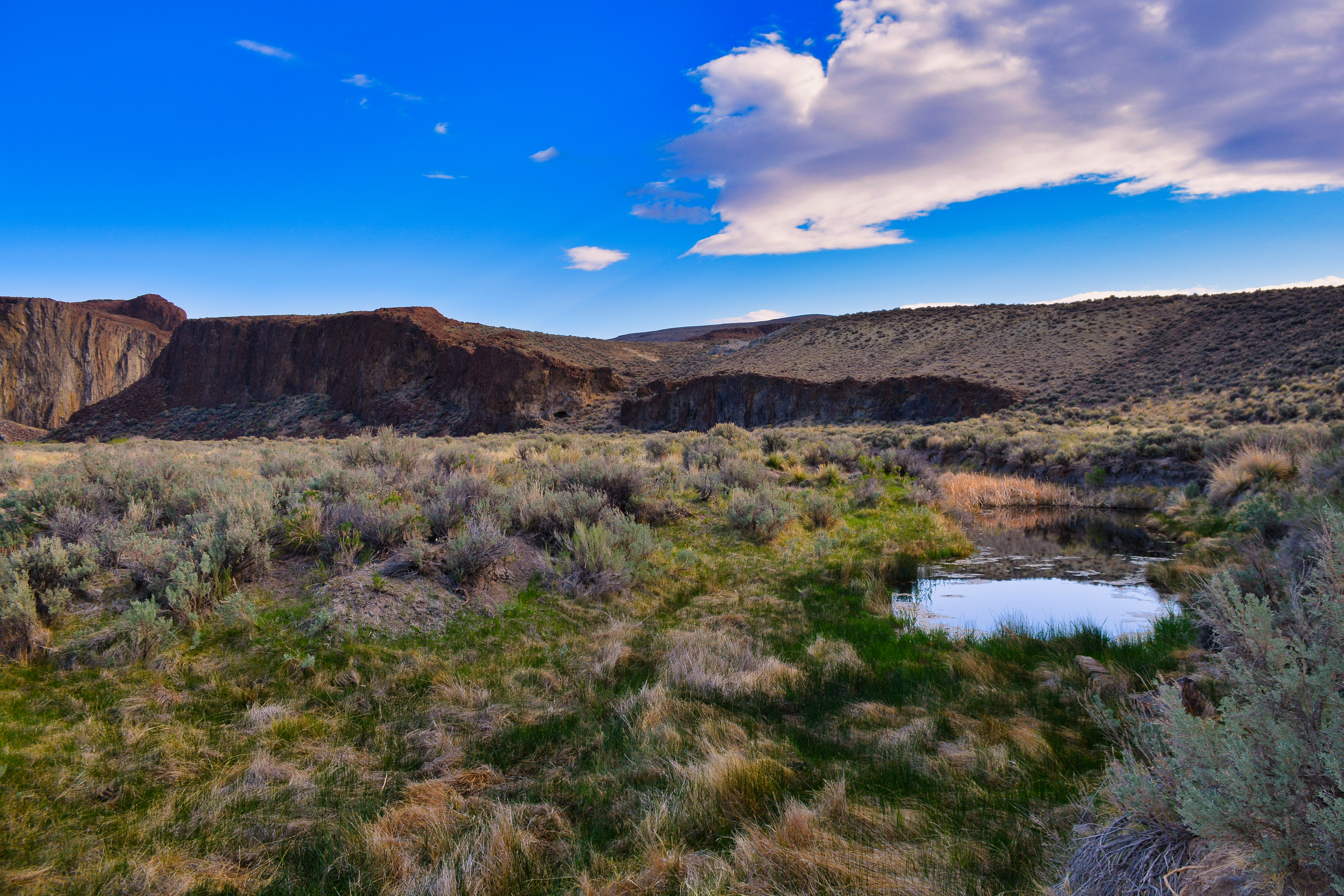
The double-hot spring is aptly named. At 185° it will boil man and beast alike. This was our destination for the night. Stacey presented some background on the spring before instructing the group to set camp. The water in the spring is crystal clear. Hot enough that there is little eutrophication in the outgoing hot creek. A hint of sulfur hung in the air. Sarah, the Natural Sciences Program Administrator for WOLF, took to examining the plants and insects around the spring. I maintained a death grip on Finn’s little arm in fear he’d slip off the bank.
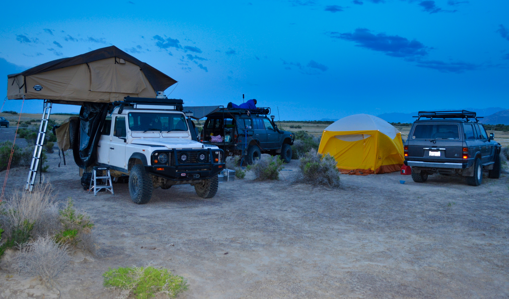
The camp area was… crowded. The spacing of camps was such that being close to someone else’s group was an inevitability. In keeping with etiquette, we chose ours as best as possible, hoping to make quick friends with our new neighbors. A party of our size would not go unnoticed.
Camp was set and as expected, the return of our neighbors required handling with gentle diplomacy. Following an initial conversation, ripe with agitation, we felt things had calmed sufficiently. The NCA, contemporarily, is not a place of conflict. Neighborly bonds are easy to establish.
Incline Village, NV August 2020:
A letter from the IRS was the first piece of mail that I opened while sitting in the driver’s seat outside of the mail center, still wearing a mask. Not too often are communications from the IRS joyful occasions, but today’s letter was a notification that the Wildwood Open Lands Foundation’s application for non-profit 501(c)(3) status had been granted.
I immediately crafted a quick email to the Board of Directors letting them know the great news. After tapping ‘send’, I scanned my inbox and found a message from Stacey Wittek (FBRBR Exec. Dir). She was reaching out at the recommendation of a friend who had attended a presentation we had given to a local off-road club. The FBRHR was interested in talking to us about a concept for a new program in the NCA.
Throughout team preparation leading up to the beta, there was an air of enthusiasm surrounding the idea of a dutch oven competition. Each chef was to prepare a dish for the group meal. Four vehicles prepared five ovens. Bragging rights were at stake.
Nature played its own wildcard. A cold front crossed the region bringing wind, lightning, and spate of heavy rain. The brilliant blue sky succumbed to a charcoal grey wave. The turbulence and beauty of the storm washed over the camp.

The culinary result was outstanding. Shepherd’s pie, lasagna, balsamic braised chicken, seasoned bread sticks, and berry cobbler set a very high bar for the gastronomic creativity of the team. In the end, the youngest of the chefs had been deemed the champ for delivering multiple offerings to our table.
The storm clouds passed on. Twilight became night. Stillness returned to the desert. Sarah delivered a presentation on the nocturnal life of the playa. As darkness closed in, we set out with black lights to search for Caraboctonidae and Vaejovidae, two of the four families of scorpions that are native to Nevada. Scorpions fluoresce under a blacklight (300-400nmλ specifically). The fluorescence is due to the chemical compounds beta-carboline and 7-hydroxyl-4-methylcoumarin in the thin hyaline layer of their exoskeleton.
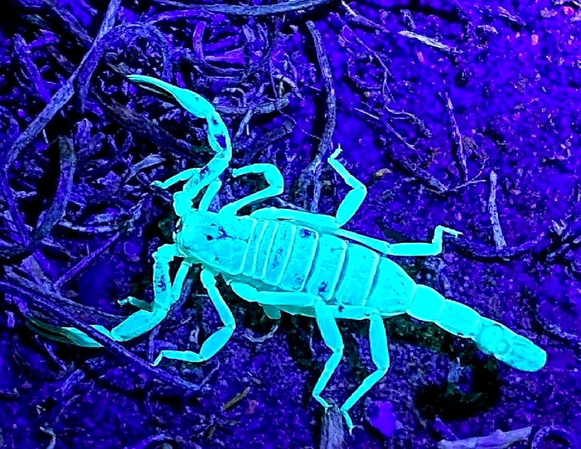
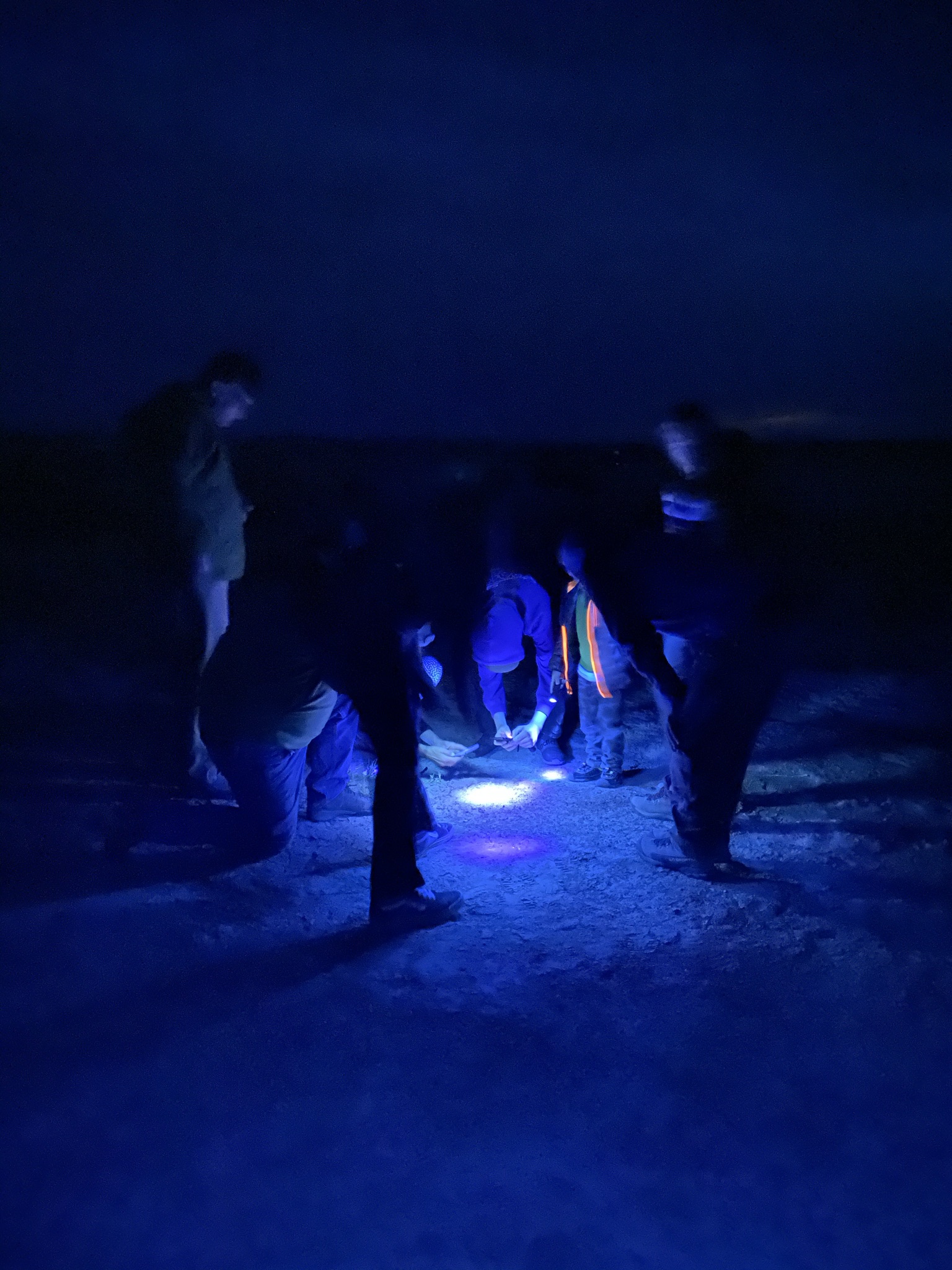
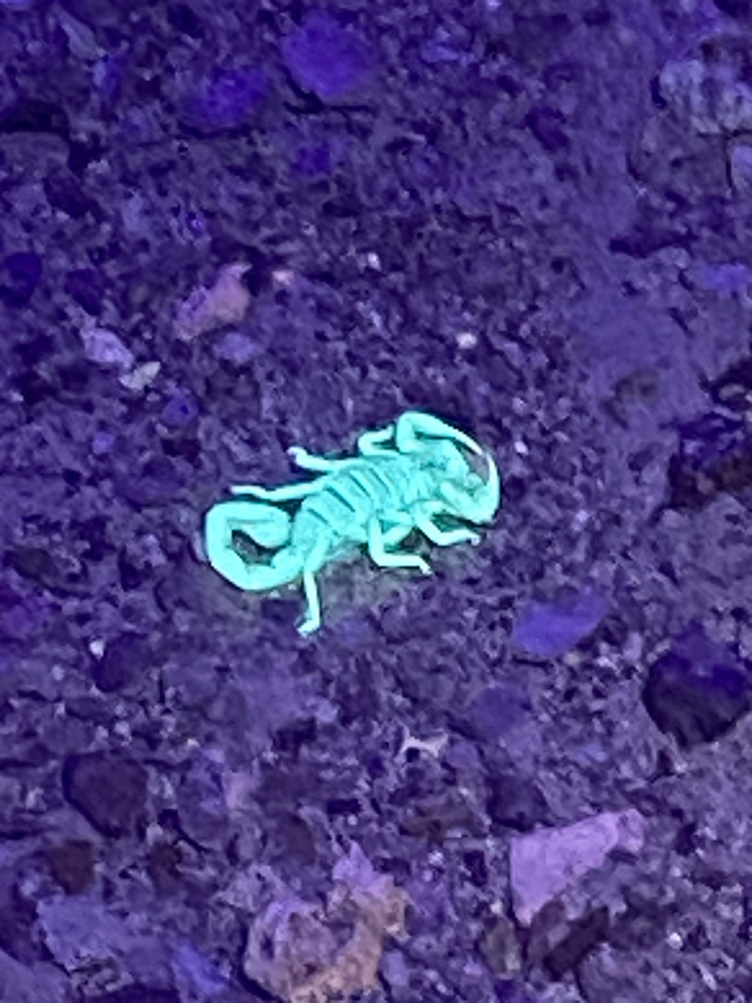

Wandering through the sagebrush slowly and unsuccessfully at first. Then a very small specimen, perhaps 3/8 inch across. As the sky drew even darker there was a second, and a third, and then the entire camp was crawling. Adults became gleeful children, scampering from one cluster of sagebrush to another, chasing the green glowing creatures about. At the end of the evening, tents were zipped tight!
High Rock Canyon, NV, September 2020:
“I need you… and your winch” – Dan called over the radio.
“You can have both over a beer once we reach camp” – my snarky response.
It had been a second long slow day on the trail with a sizable group. The camp was expected only a mile or so ahead. We had been exploring the Lassen-Applegate Emigrant Trail with the FBRHR for several days. The intent of this trip was to understand the scale and complexity of the historical trail within the National Conservation Area to determine if there was a viable experiential service opportunity worth developing.
“No, I really need you, and your winch. Now, please”. Dan’s calm tone was a trigger that he was not joking around. I switched over to the group channel and asked the convoy to pause until we could get a handle on the situation. I spun my defender around and headed back up the trail.
I found Dan and his FJ60 perched precariously off-camber on a steep, loose slope above the creek. The outboard edge of the trail had given way beneath the weight of his Landcruiser. There were no natural anchors to winch off. We called for the heaviest vehicle in our group (a long-wheelbase sprinter van weighing roughly 11,000 lbs). Our plan was to set two winch lines to pull and pivot the cruiser back onto the road cut.
After a tense few minutes of rigging and winching, we were back on our way towards camp where the rest of the group was already cracking open beers. Tragedy and damage were averted. Valuable experience had been gained.
Early the next morning I may have been the first to mill about camp. A cool, gentle breeze brushed between the vehicles and tents. Today was expected to be a long trail day. Our intention was to cover a good amount of ground. Several stops were planned along the way to talk at historical sites. The route included a bit of technical terrain in High Rock Canyon. The excitement of the scorpion search carried over through breakfast.

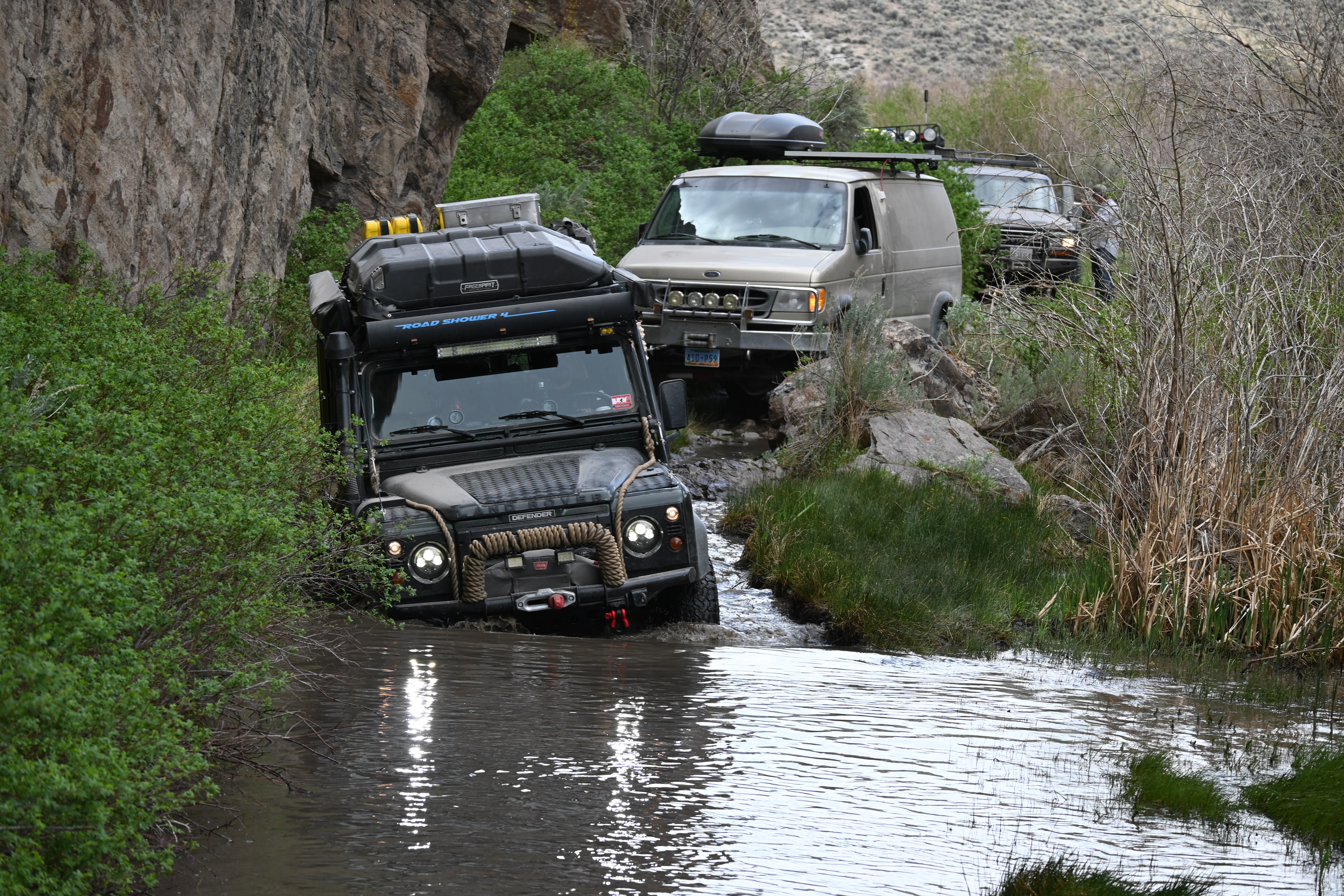
The first water crossing is located south of the hot springs at Soldier Meadow. The roadway traverses an ecologically sensitive area. In the months since our last passing in September 2020, the area has seen a significant amount of human-caused degradation. During our previous trip, the crossing was a short, cobble-bottom creek. Now it had tripled in length and eroded into a deep two-track. There was evidence that vehicles had experienced trouble here. A series of rough tracks through the wetland area extended to the north side of the crossing.
Our first three vehicles achieved the crossing with minimal complication. The other D110 in our team became high-centered and was winched back to solid ground. I made the judgment call to lean towards the left shoulder of the trail. This decision allowed the remainder of the group to pass smoothly but not without encroaching into the vegetated bank.
This became a hot point of contention. If the program is expected to offer a low-impact off-road experience, then I’d given instruction violating those principles and made a foundational mistake. Beta experience or not, this tour was expected to resemble how commercial offering would be conducted. A portion of the team, rightfully, and strongly, expressed their disappointment (understatement).
To frame what had just happened in some background context; when operationalizing this program during the winter of 2020-2021, we set out to create a packaged service that could be handed off and operated by others. We wanted to provide good direction to field guides for times when a judgment call would arise. So, a set of guiding principles was established. 1) Safety of every member of the team; 2) Safe passage of vehicles & equipment; 3) Minimize risk of impact to the ecosystems of the NCA; 4) Adherence to the planned route and schedule. By embarking on this Beta-test of the program, we’ve uncovered a scenario which place those guiding principles into conflict.
Later in the day, once settled comfortably into camp, it seemed appropriate to open the discussion with our skilled and experienced teammates to help us to break down and understand what had happened earlier. This started by asking some critical questions. How could we have affected a different outcome? Was it possible to make an alternate decision? Did we effectively share our guidelines? Could that have led to a different choice? Were our priorities properly aligned to provide guidance for successful decision-making?
The feedback from the multidisciplinary background of the group crosscut several opportunities to improve the program. These ranged from clearer sharing of expectations-instructions, technical operations for trail leads, and empowering anyone in the group to call ‘time-out’ if something doesn’t look or feel right.

Pressing on, we made several stops before entering High Rock Canyon proper. The wagon slide is a feature of historical significance and achievement of will. Imagining the westbound emigrants winching loaded wagons into the canyon with rudimentary block and tackle made our kerfuffle at Soldier Meadow seem puny in comparison.
All vehicles reached the towering cliffs at the post office caves by mid-afternoon. The sun had heated the walls of the canyon as bricks in a stove. There wasn’t enough time to make it to the Fox Homestead where we had planned to camp this day. Simply too much ground left to cover. The team demonstrated signs of fatigue.

We parked up around the post office caves, which have served as a shelter for passing travelers for centuries. This was an acceptable spot to stay here if there was no alternative. However, it would be a less than ideal accommodation.
Had to double lock wagon wheels and slowly lower the wagons. Sudden outflows of water from High Rock Lake tore away the rock of Fly Canyon. Violent vortices of water and rock drilled holes in the streambed. Emigrants passing through this canyon noted huge potholes in the stream bottom with one almost one hundred feet wide and undercut twenty feet at the bottom.
J Goldsborough Bruff 1849[vi]
While the group explored in and around the post office caves, Stacey and I headed up-trail to scout options. About a mile north, the flat of Conlon Camp at the mouth of Mahogany Canyon was available and would accommodate our needs nicely. Wasting no time, the team relocated onto the grassy meadow.
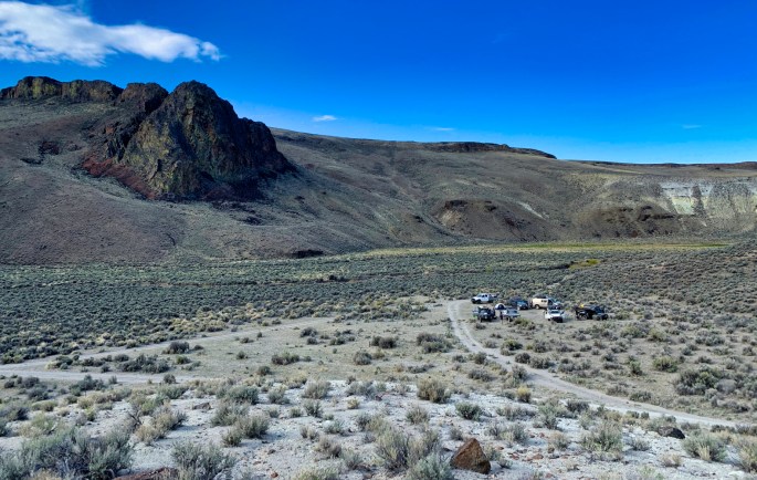
Now at camp, plenty of daylight remained which allowed for ample unstructured time for the group to break off and explore on their own. The terrain surrounding Conlon Camp is rocky peaks, cliffs, caves, and wetland beneath a side canyon provided the exact dynamic we had hoped for. This overnight spot was far superior to the plan.


When a team is successful, particularly under circumstances outside of individuals’ comfort zones, and when forced to overcome some adversity, a sense of camaraderie quickly grows. Our group of strangers adopted a tribe mentality of support and respect over the course of a short time together. A sense of cohesiveness and unification emerged. Differentiation between those who had organized the trip and those who chose to attend disappeared. As daylight slipped away, and without coordination, a celebration of food and libation transitioned to campfire, laughter, and storytelling late into the evening.

Our last trail day included the most dynamic terrain that we would travel together. Between Conlon Camp and Fox Homestead lay several water crossings, short climbs, and a few tighter cruxes.
The team had hit its stride, addressing each challenge without incident. They spotted each other through technical sections. The mindfulness of supporting each other smoothly along the trail was undeniable.


The remote Fox Homestead lies at the mouth of Yellow Canyon (named for the bright sulfur-laden formations in the surrounding cliffs). Some folks explored the historical site, and some climbed into the caves above. Others took a short hike into the canyon. The warmth of the morning sun had chased away the chill of the previous night.
Gerlach, NV May 2021:
Stacey Wittek (FBRHR Exec Dir) and I scrambled to tie up loose ends at the FBRHR visitor center and finish loading gear into her truck. Today’s mission: to ensure that the playa would be safe to cross with the group, drop GPS markers, and finalize all the speaking topics for the beta tour now less than a week away.
Once on the playa proper, we proceeded in the general direction of the designated route on the northeast end of the pan. About halfway out I dropped our first marker and checked the firmness of the track. Across the playa this sequence of the surface evaluation was repeated several times.

At Black Rock Point we took some time to remove a firepit and several structures that had been built in the hot spring by other visitors. This was Stacey’s first time taking her new rig, an x-Terra named Rozie, off-road so her driving technique was a bit cautious as she gained confidence in its terrain handling.
Our map indicated a shortcut towards a well-used road on the west side of the valley. This side trail is a smooth, sandy track, crossing the true Lassen Applegate trail (which clearly had not been walked by human feet in some time), and startled a pair of wild horses grazing in the scrub.

Cresting a low ridge around the south corner of Wheeler Reservoir it became clear why this route was so seldom traveled. The trail disappeared beneath feet of water, far too deep to ford, far too delicate to disturb. This small corner of the NCA beckons another trip for more focused discovery. For now, we needed to let it be and move on.
Outside the Northern gate of High Rock, the trail smoothed, and our pace hastened. One last stop at Stevens Camp Cabin for a quick lunch and a debrief. This was our planned trip terminus. We wanted to collect as much feedback as possible while still together, good or bad. The comments will inform how WOLF and FBRHR choose to proceed with program development. Overwhelmingly the responses were positive and rich with constructive recommendations. For that we are grateful.

Hugs, goodbyes, and thank you’s all around. After bidding our final farewells to the group, Darla, Finn, and I were once again our own, headed towards home. Thunderstorms washed the playa dust from Angus as the sun fell gently towards the horizon leaving a procession of rainbows in the east.
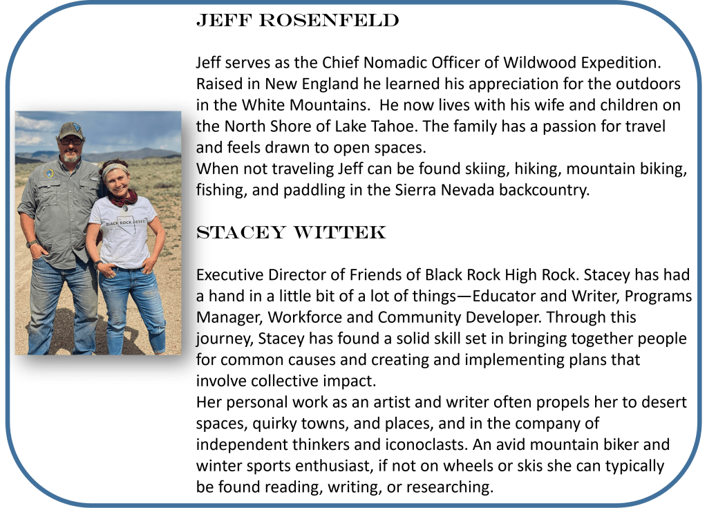
About the Authors
Special Thanks to our Contributing Photographers:
Sawyer Coll
Jim Eliot
Aaron Hagar
Carlo Luri
Darla Rosenfeld
Contact:
jrosenfeld@wildwoodopenlands.org

Contact:
SOURCES
[i] Ferol Egan. Sand in a Whirlwind: The Paiute Indian War of 1860. Reno, NV: University of Nevada Press, 1985.
[ii] Fairfield, Asa Merrill, Fairfield’s pioneer history of Lassen County, California, H.S. Crocker, San Francisco, 1916
[iii] Brooks, Christopher, Black Rock Desert, Acadia Publishing, 2013
[iv] Diary of Lucy Ann Henderson 1846, Child’s Play: Freak Accidents on the Westering Trails (U.S. National Park Service) (nps.gov)
[v] Dodd, Charles H., Chuck Dodd’s Guide to Getting Around in the Black Rock Desert & High Rock Canyon, 3rd Edition, 19th Century Publications, USA, 2006
[vi] Diary of Joseph Goldsborough Bruff 1849 [Diary of J. G. Bruff] – Yale University Library
